The Westside, one neighborhood at a time
The numbers are measured from public records; the local read is still being written.
Neighborhoods and their sub-neighborhoods
- Bel Air
Lower Bel Air · Upper Bel Air · Bel Air Crest · East Gate - Beverlywood
- Brentwood
Brentwood Hills · Brentwood Glen · South Brentwood · Brentwood Terrace · Brentwood Park · Mandeville Canyon · Mountaingate · Oakmont · Crestwood Hills - Castle Heights
- Century City
Century Glen - Cheviot Hills
- Culver City
Fox Hills · Carlson Park · Culver Crest · Blair Hills · Clarkdale · Jefferson · McLaughlin · McManus · Park West · Sunkist Park · Studio Village · Lucerne/Higuera · Culver West · Downtown Culver City - Del Rey
Marina Arts District - Ladera Heights
- Mar Vista
South Mar Vista · West Mar Vista · North Westdale · Mar Vista Hill · Westdale · The Wood Streets - Marina del Rey
The Silver Strand · The Marina Peninsula - Pacific Palisades
Castellammare · Palisades Highlands · Marquez Knolls · Temescal Canyon · The Alphabet Streets · Rustic & Santa Monica Canyon · The Riviera · Huntington Palisades · Las Casas Loop · El Medio Bluffs · The Summit · Ridgeview Country Estates · Pacific View Estates - Palms
Westside Village · Downtown Palms - Playa Vista
- Playa del Rey
The Jungle · Lower Playa · Playa del Rey Hills - Rancho Park
- Santa Monica
Northeast · Sunset Park · Mid-City · North of Montana · Ocean Park · Pico · Wilshire Montana · Downtown Santa Monica · Civic Center · Ocean Front · The College Streets - Sawtelle
Japantown - Venice
East of Lincoln · Oakwood · Presidents Row · Venice Beach · The Canals · Abbot Kinney · Oxford Triangle · Milwood · The Silver Triangle · North of Rose - West LA
- Westchester
Kentwood · East of La Tijera · LMU · Loyola Village · North Kentwood · Westport Heights - Westwood
Westwood Hills · North Village · Comstock Hills · Wilshire Corridor · Little Holmby · South of Wilshire · UCLA · Westwood Village · Holmby Hills
Westside basics
- Los Angeles, Santa Monica, Culver City or the County? Which city a Westside address is in, and why it matters
- How the Westside of Los Angeles is laid out: freeways, boulevards and its 22 neighborhoods
- Free public tools for looking up a Westside Los Angeles address
- LAX flight path: which Westside neighborhoods get aircraft noise, measured
- Westside Los Angeles neighborhood boundaries: where each one starts and ends
- Westside Los Angeles school zones: how attendance works in LAUSD, Santa Monica and Culver City
- Street parking on the Westside of Los Angeles: permit districts, sweeping and the rules by city
- What homes sell for in each Westside Los Angeles neighborhood
- The most walkable Westside Los Angeles neighborhoods, measured on foot
- Living on the Westside without a car: rail, buses, walkable pockets and the D Line
- The quietest streets on the Westside: how far from the freeway and busy boulevards
- The most tree-lined, shaded streets on the Westside, measured
- Where to find older homes on the Westside: home ages by neighborhood
Compare two neighborhoods
- Mar Vista vs Palms
- Del Rey vs Marina del Rey
- Westchester vs Playa del Rey
- Venice vs Santa Monica
- Culver City vs Palms
- Mar Vista vs Culver City
- Playa Vista vs Westchester
- Playa Vista vs Marina del Rey
- Brentwood vs Pacific Palisades
- Westwood vs West LA
- Sawtelle vs West LA
- Cheviot Hills vs Beverlywood
- Rancho Park vs Cheviot Hills
- Castle Heights vs Beverlywood
- Mar Vista vs Venice
- Del Rey vs Mar Vista
- Santa Monica vs Brentwood
- Century City vs Westwood
- Ladera Heights vs Westchester
- Playa del Rey vs Marina del Rey
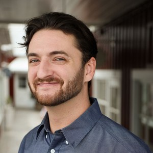
Nate Baldridge · The Portnoy Team · Compass
Nate made The Westside Map. Ask him about a particular street, building or price: call or text (424) 672-5129 or email him.
Realtor® · California DRE 02247406
Sources for the figures on this page: LA County Assessor parcel roll (Sept 2026); LARIAC6 building outlines (2020) and LARIAC7 tree canopy (2023), LA County; City of LA street-tree inventory; LAUSD attendance boundaries (LA GeoHub), the NCES 2015-16 attendance-boundary survey (Santa Monica-Malibu) and the CCUSD address listing; California Department of Education school sites, 2024-25; California Protected Areas Database (www.calands.org), June 2026; LACMTA, Big Blue Bus and Culver CityBus GTFS; LA County highway plan and city street classifications; published airport noise contours; LADOT parking districts; © OpenStreetMap contributors (ODbL).